

Monday morning, 10:38.
There was the picture I took of the Quail Hollow pool — which is normally right next to the Saluda River — at 1:09 p.m. Sunday.
Then there was the one I took at 5:18 p.m. Sunday.
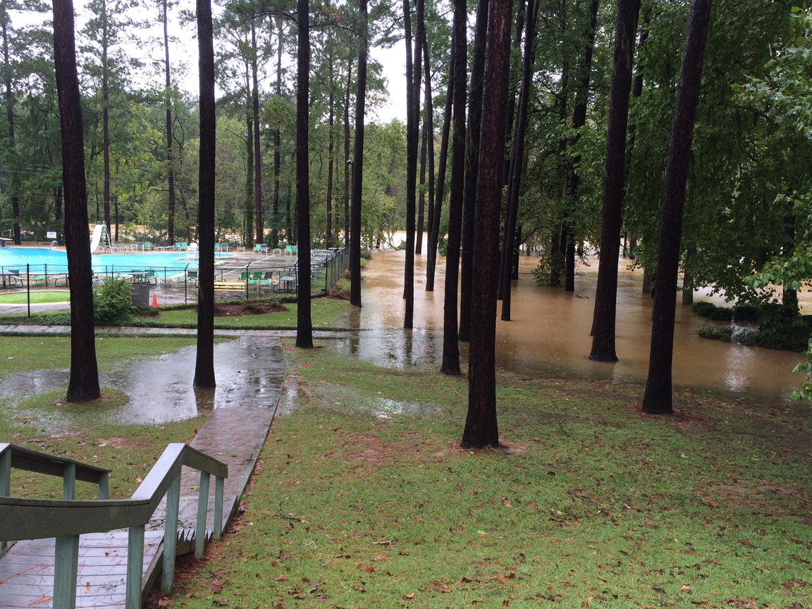
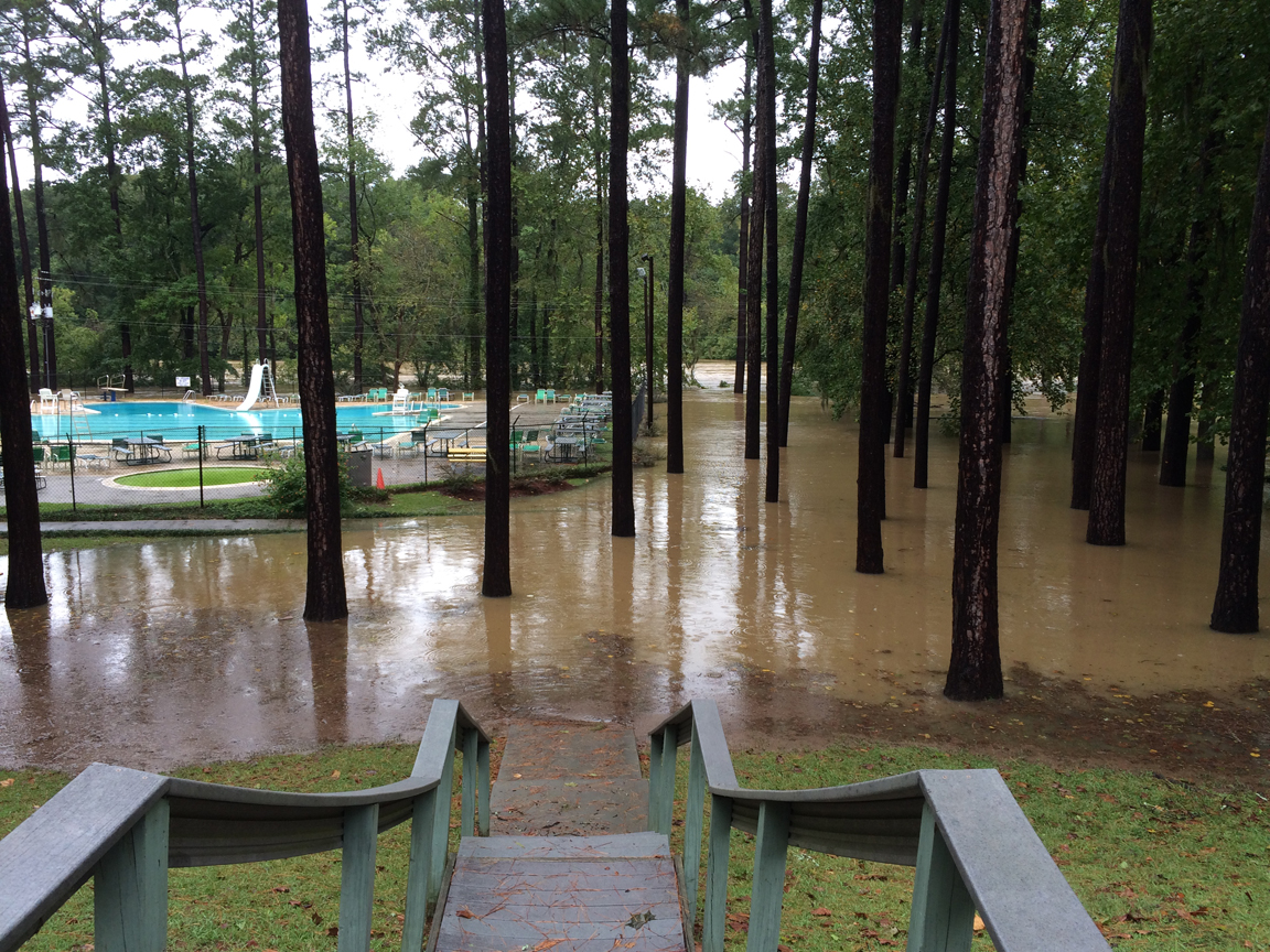
This morning at 10:38, the pool was no more to be seen.
Now, let me put this in perspective — especially for my kids in Thailand, who are worried about us: This represents a rise of a couple of feet in about 17 hours. It would still need to rise two or three yards to reach the street, which is the lowest-lying road in Quail Hollow — which is what, 50 feet or so from the high ridge that we are on.
So we’re fine. Our neighbors who spent the night with us because they were told to evacuate checked on their house this morning and there’s no water anywhere near it.
We’re fine.
In fact, watching this slow rise of the river through these images is sort of reassuring. If not regular and normal, it as least has a slow, plodding predictability to it. So we’ve got that going for us, which is nice.
Related Posts

Something that made me smile. You can’t quite read it in that picture, even if you blow it up, but you see that sign that is on the partly-submerged fence on the far side of where the pool was? It’s just to the left and a bit behind the blue sliding board.
It says, “NO LIFEGUARD ON DUTY.”
No kidding.
Except that’s not entirely true. There is a sheriff’s car sitting there on the road, probably to keep an eye on all of us who keep going down to look at the river. And while I was there, another sheriff’s car came by and checked on that one.
Another thing that testifies to me that all is in hand, everything is fine. Things have taken on a routine…
Glad you are okay.
The beige thing at the lower right part of the image is a floating picnic table. To the left of it, those dark floating things are the kind of wheeled garbage bins that you roll down to the curb.
In the distance, within the river’s normal banks, it’s moving VERY swiftly…
If you look closely at this picture from this morning (10:41 a.m.), you can see how much the river has risen in absolute terms since about 1 p.m. yesterday.
Remember the video I shot of the tennis court area yesterday? Well, the photo above is at a slightly different angle because I’m higher up — the place where I was standing yesterday is under water. But if you look at the tennis court fence in both images, you can see that the water has risen about four feet.
Here’s a still from yesterday’s video:
You can see that the low fence that runs across two-thirds of the image yesterday is now invisible, while the water is four or five feet higher on the high fence at left, which surrounds the tennis courts. Also, and I’m just noticing this — the high fence that was perpendicular to the water flow appears to have been pushed down and submerged.
When SCANA closes the spillway on the lake the Saluda will begin to drop. Until that happens, I would bet on a rising river over a falling one. But hopefully, the pace of the rise will begin to slow down. The Zoo seems to be the place facing the greatest risk of inundation, if it isn’t seeing that already.
This is truly an epic disaster for SC. All y’all stay safe and out of the water.
In North Springs we never lost power or running water (still boiling it). The neighbor had a tree roll over. From my stay-put position the neighborhood has fared well. The closest road with a washout is Polo. The school district tells us the schools have suffered no damage, which is remarkable considering there are 40 of them.
I just want to see the sun again….
We walked around our neighborhood this morning, which is on the other side of the 26, same side of Saluda from Quail Hollow – Westover Acres and Saluda Terrace. There was one place we saw where the water was up around a house that was built pretty close to water line. In most places people didn’t build right on the water, but you could see where the water had come in farther than normal. We talked to a man who let us look in his back yard. He said the water is only a little higher than it was when they were building the back up dam and were letting water into the spillway then. I have a picture from there. I’d put it in here if I knew how. You can see the regular river channel in the distance through the trees and the water up among the trees. It looks alot like the quail hollow pictures. All the places we could see the river channel, it was swift and loud.